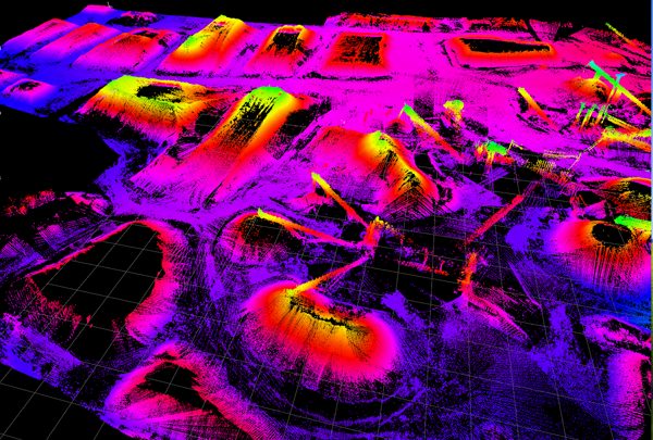
 H2H Geoscience Engineering uses state-of-the-art surveying technology to provide highly accurate and cost effective physical inventory solutions. Our mobile and static 3D laser scanning equipment allows us to collect millions of data points on irregular surfaces very quickly.
H2H utilizes the latest point cloud data processing software to quickly and accurately develop stockpile inventory quantities for our clients. Our depth of experience and attention to detail allow us to guarantee accuracy within 1% repeatability on any unchanged pile.
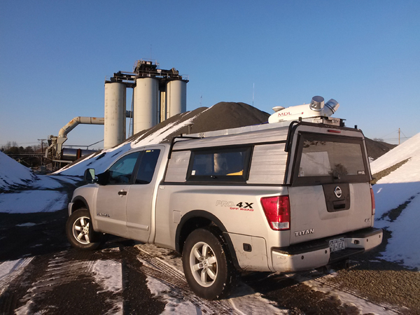 Mobile and static 3D laser scanning
- Cost-effective stockpile physical inventory solution
- Guaranteed accuracy within 1% repeatability on any unchanged pile
- Safe – greatly reduces the need to have personal on the ground
- Can be performed in all weather conditions
- Real time QA-QC – data is streamed during collection, ensuring the highest levels of accuracy
- Solely 3rd party
- Fast turnaround time
- Data is processed using the latest point cloud processing software available
- Deliverables are tailored to clients preferences
H2H Geoscience Engineering has performed stockpile physical inventory assessments for mining industry clients in North, Central, and South America, and for federal agencies including the Defense Logistics Agency.